Bo’s First Alert 6 Forecast - Spotty strong storms until 11 PM, dry & comfortable Sunday
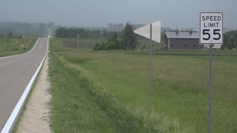
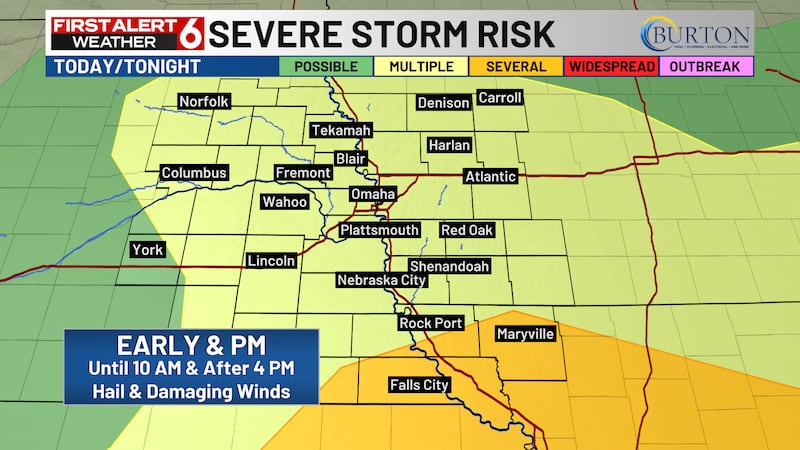
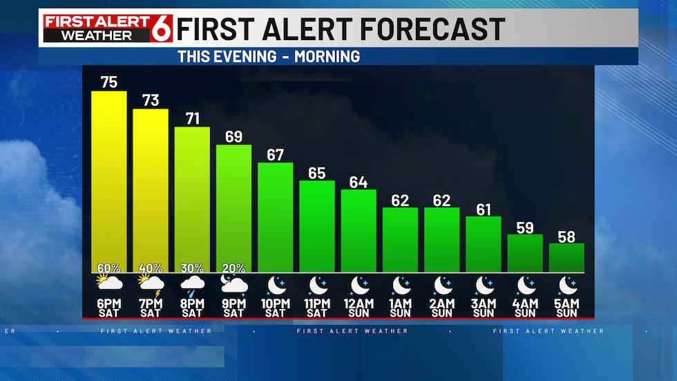
OMAHA, Neb. (WOWT) - The second round of scattered storms have begun to form as of 5 PM and will continue through 11 PM. A few storms could be severe especially south of I-80. A Severe T-Storm Watch has been issued for southeast Nebraska and far southwest Iowa until 11 PM.
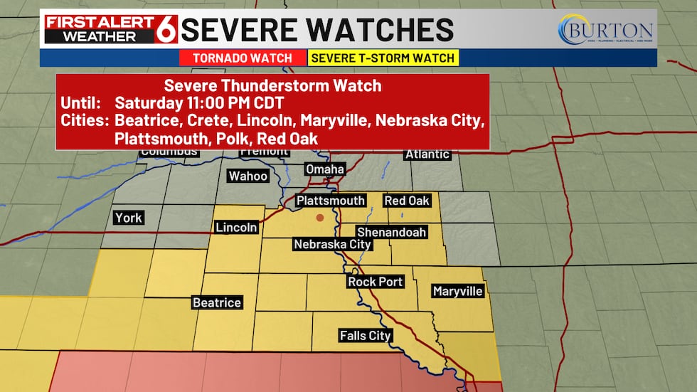
The main threats are large hail exceeding 2″ in diameter and damaging winds reaching up to 70 mph. While the tornado risk is low, a spin-up or two can’t be ruled out.
The start of the Texas vs Georgia baseball game could be impacted by storms especially at the start of the game. Towards the end, the storm potential decreases but there still could be a delay.

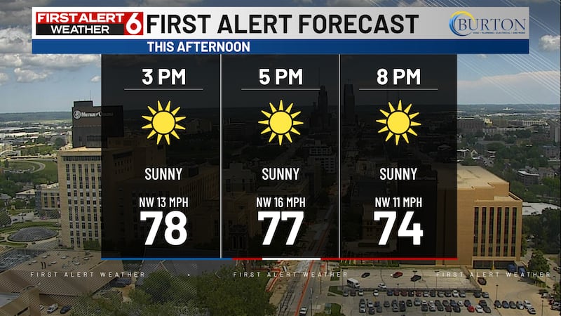
After 11 PM, the clouds will clear out eventually becoming mostly clear. Lows will fall to the mid 50s.
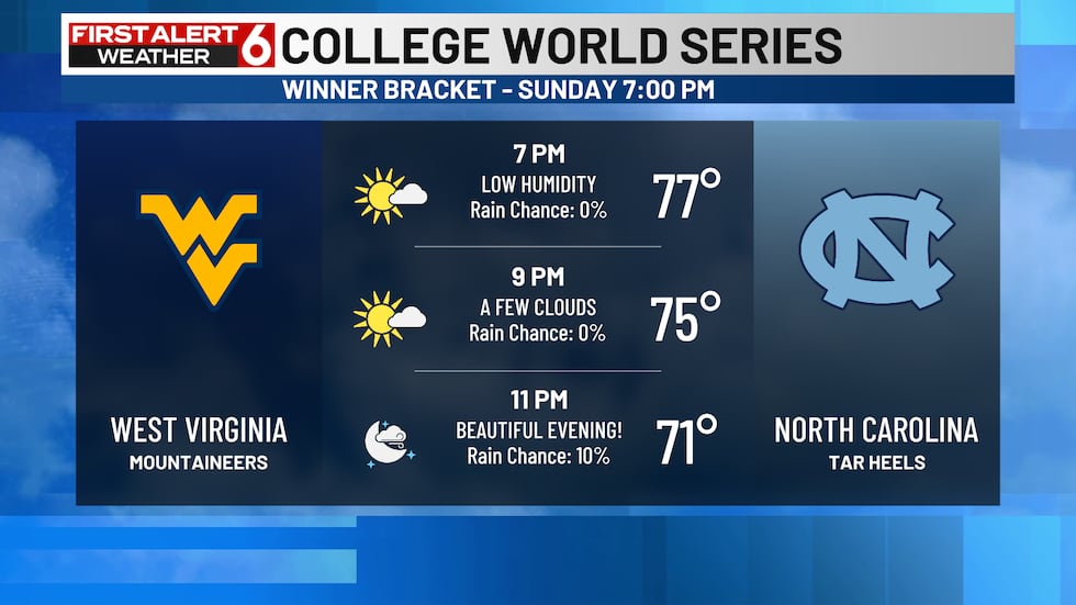
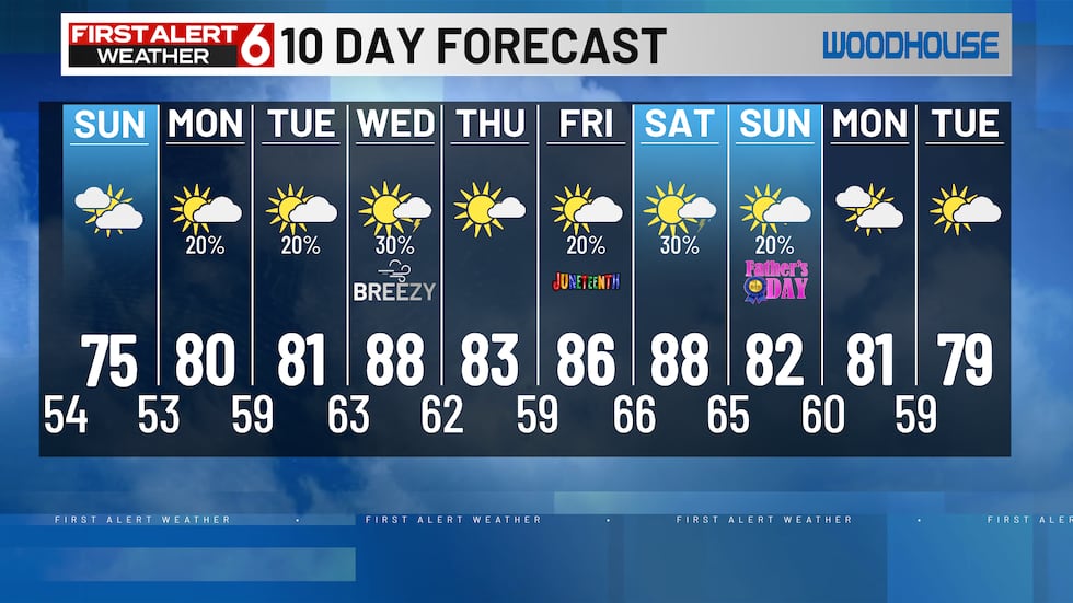
The mugginess will subside again for Sunday with some cloud cover keeping us in the mid 70s. It’s going to be a great day for more college baseball including Troy vs Ole Miss at 2 PM as well as the West Virginia vs North Carolina at 6 PM.

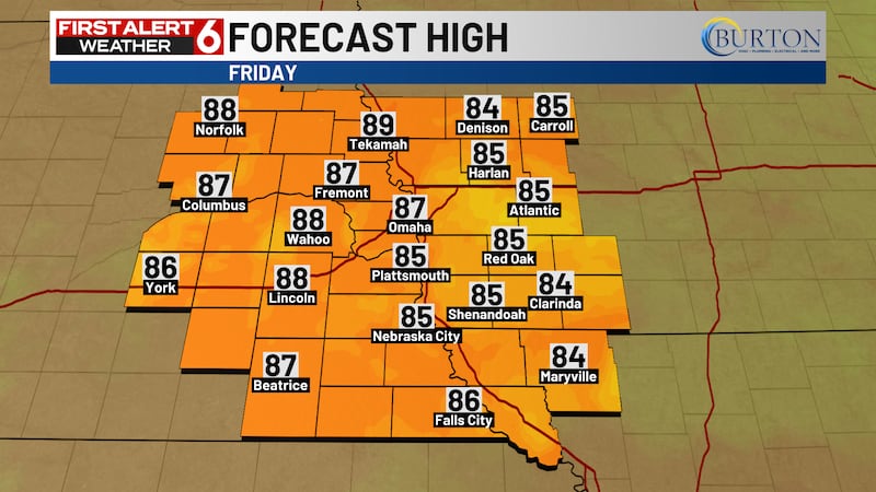
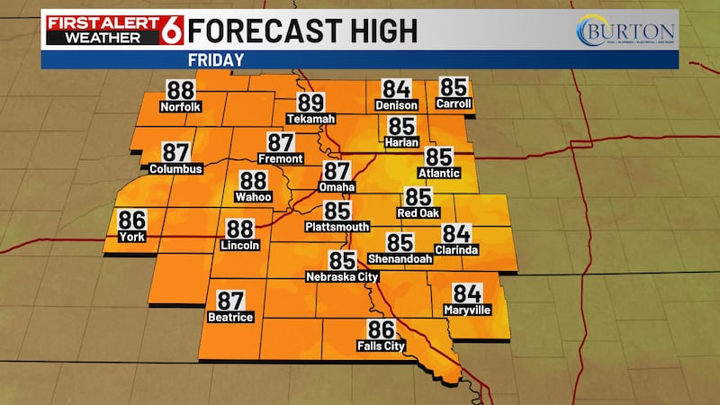
There will be a slow warming trend over the next few days with highs back near 90 degrees by Wednesday.
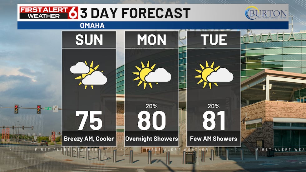
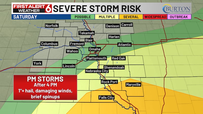
Storm chances return by late Tuesday into early Wednesday and some could be severe. The Storm Prediction Center did issue a severe outlook for southwest Iowa and far southeastern Nebraska.

Copyright 2026 WOWT. All rights reserved.